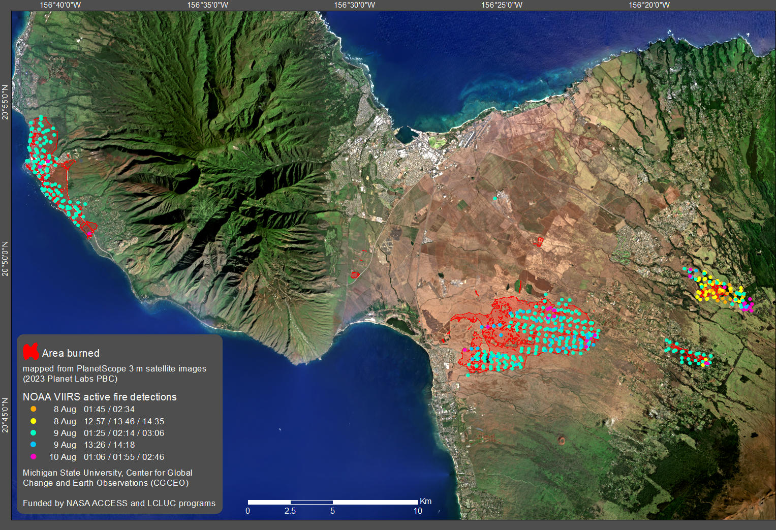
New images use AI to provide more detail on Maui fires
Michigan State University researchers have produced highly detailed maps of the recent wildfires in Maui using high-resolution satellite images, which can be used to determine where postfire remediation activities should be prioritized and to assess future fire risk.
